
Luohan Pagoda, North Heavenly Gate
Fengguan Beiqiao refers to a section of cliff in the north of the peak of Phoenix Mountain, all kinds of strange rocks and strange stones, dangerous cliffs are full of it, climb the Luohan Tower, cross the North Tianmen, climb the mountain and break the valley of the senior hikers like to challenge the dangerous place. Luohan Pagoda, also known as "Phoenix Bun", is a natural stone pagoda located on the northern ridge of Phoenix Mountain, and the North Heavenly Gate is located in its adjacent valley. Take the MTR to Tung Chung Station, take Exit A to Tung Chung Road, find the entrance of Shek Mun Ka Village, walk along Shek Mun Ka Road to the bus terminus, go around to the cement path behind Luohan Temple via Famen Ancient Road, and then wind up the road to the cement junction near the right, find the entrance of the ribbon and start climbing. This section is steep and rugged, requiring a combination of hands and feet, and will pass through rocky formations, which will slip carefully after rain. After crossing the rock formations, the road is slightly gentle, and the Luohan Pagoda and the "One Tree Cave" are already in sight. Walk to the bottom of the Luohan Tower, the left trail ascends to the top of the tower, the rock has a certain height, you need to pay attention to safety. The top of the tower is a pile of rocks, like an isolated island in the mountain, climb high and look far away, there is Dadong Mountain in the east, there is Maitreya Mountain in the west, the back is Phoenix Mountain, the momentum is extraordinary; You can also take advantage of this time to determine the direction of the North Tianmen and the Tianmen Plank Road that you need to climb in the future. Return to the bottom of the rocks and turn right at the intersection to continue to Beitianmen. Follow the canyon down a section to the Stone River in Cao Xi, climb to the right to the Tianmen plank road, part of the plank road is located on the edge of the cliff, be careful to pass along the border, do not rely too much on auxiliary ropes. The North Heavenly Gate is not far from the Luohan Pagoda, but it is not so easy to approach, try to climb to the right when climbing, and the cloth strips hanging from the predecessors on the plants can also be used as a guide, but these cloth strips are old and not obvious, and need to be carefully identified. If you climb the stone wall in a zigzag shape, you can see the horseshoe gorge under the North Heavenly Gate. After connecting to the jungle road, follow the valley to the Phoenix Gate - the depression between the Phoenix Peak and the Phoenix Peak, and go right to climb the Phoenix Peak. Finally, take the Phoenix Trail to the left and descend to Pak Kung Pass to complete the journey. The difficulty of this route is that you need to climb many rocky slopes, which is a great test of skill and physical strength.
Recommended Attractions:
Luohan Tower. North Heavenly Gate
(Difficulty: 5 stars)
Starting point: Tung Chung Station Exit A
Dogtooth Ridge
Dogtooth Ridge belongs to the southern branch of Phoenix Mountain, divided into three branches, eastern, central and western, all of which can be reached by mountain roads, and are extremely dangerous and steep, suitable for climbers who like to challenge to high difficulty. Get off at Shek Pik Reservoir bus stop, walk for 5 minutes towards Mui Wo, come to the gate of Tong Fuk Diversion Road, and then arrive at Benett Kei Trail, and follow this road for about 1 hour until you come to the entrance of West Dog Tooth Ridge in front of the danger warning sign. This is a long and steep journey, and you need to use your hands and feet to climb, and from the ridge of the low trees, you can see the Buddha in the distance, and the Nakadoga and the "Hades Wall" that you need to climb later. The path to the main peak is the most treacherous, with cliffs on both sides and ridges that stand like blades, so you need to be careful to deal with. Then we reach the summit and come to the so-called "glimmer of life", which is a cliff separating the middle and west dogya, and one section of the stone wall can only accommodate one person to pass through. After a short gentle descent road, you will begin to climb the "Hades Wall", although the name is impressive, but in fact it is not dangerous, and you can pass safely by paying attention to the road conditions under your feet. Then go down the mountain after the "whistle tooth stone", and connect the Phoenix Trail at Chop Chai Pass, where visitors can choose to climb the Phoenix Mountain or go directly to Ngong Ping according to their own conditions. The route to Dogtooth Ridge has a drop of nearly 900 meters from the ground to the top of the mountain, and also passes through narrow cliffs, which is not suitable for those who are physically exhausted, afraid of heights and lack of mountaineering experience.
Recommended Attractions:
Dogtooth Ridge
(Difficulty: 5 stars)
Starting point: Shek Pik Reservoir Bus Stop
Hinterland of green mountains
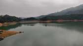
The hinterland of Castle Peak is a barren and unruly area in the northwestern New Territories, which has been washed by wind and rain for many years and the baptism of shells in the nearby military restricted area, forming a variety of rare ravines. Walk from Tin King Road San Wai Station to San Wai Court, turn left at the intersection to Leung King Estate, take the cement road and go up to the main path of Castle Peak, go a few steps and turn right into the branch road to the hinterland of Castle Peak. The first section of the road is in good condition, the latter section is full of gravel, after the hill slightly descends to the intersection, choose the right mountain trail to go west, and then go to the Wudushui intersection, you can see the ridge with a clear trail in the upper left. Shortly after the road is connected, climb up a steep slope full of gravel, take the trail tied with ribbons on the right and descend into the stream, wade through the water and climb to the flat hills to reach the entrance of Crescent Valley. Crescent Valley is a treacherous and chilling sight, but careful study reveals that there is a narrow path on the left, and you can walk down carefully to the bottom of the valley. Seek the secluded and mysterious in the valley, surrounded by rough stone cliffs and turquoise trees overhead, quiet and mysterious, with a unique flavor. After the tour, return to the entrance of the valley, climb the trail on the left to bypass the crescent valley, continue up the mountain, reach the top of the valley and move along the ridge roughly to the west, you can see a narrow ravine with red soil, and many verdant pine trees grow in it, this is the "green pine red gully", this land formed by artillery bombardment, the soil color is dark red, the gully is wide and wide, and the tenacious pine trees in the valley are in stark contrast, and man and nature work together to create a masterpiece. Continue to cross the green pine and red gully, first determine the direction and ridge and then descend, and then enter the jungle to cross the creek (which may be dry or obscured), climb along the ridge to the hill, the trail behind the small hill in front of the right is looming, with a lot of sand and gravel, and you can reach the Hualang Ancient Road by stepping on this road. Walk down the forest trail around the mountainside, occasionally seeing the sea at Lung Kwu Tan in the distance, and then pass by the village houses in Pak Long to reach the Long Kwu Tan Bus Terminal. The hinterland of Qingshan has harsh geology, many gravel gravel, and the physical effort exceeds that of ordinary hiking routes; There are many slip roads and no signs, so you need to carry a map and GPS device, and go with a climber who has plenty of experience in hiking. At the same time, be sure to check the government website for announcements before you set off to avoid shelling training time.
Recommended Attractions:
Hinterland of green mountains
(Difficulty: 5 1/2 stars)
Starting point: Tianjing Road Xinwei Station
Snake tip
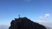
Located in the northeast of Sai Kung, the tip of the snake is known as the first of the three tips in Hong Kong, and when the weather is clear and clear, it can be seen on almost any hill in Hong Kong. It is only 468 meters above sea level, but with its unique mountain shape and treacherous terrain, it is known as "Hong Kong's most dangerous peak", and it is a mountain that all local trekkers want to conquer. Get off at Pak Tam Pass and follow the cement road next to the public toilet on the opposite side to enter the second section of MacLehose Trail, and follow the ridge all the way up, and you can see the steep peak of the snake tip in the distance. Easily ascend along the main path to the Tai Lang Pass Rest Pavilion, and walk up on the path with ribbons and warning signs on the left, you can see the scenery of Tai Wan and Yantian Bay along the way, and then pass through two warning signs to reach the fortified section. This section of the road is steep and full of mud and sand, and it is inevitable to climb two steps and slide half a step with both hands and feet. After conquering the imposing snake tip, the island of Tap Mun and Ko Lau Wan in the north, the rolling hills of Sai Kung in the west, and the turquoise snake bay and the coast of Thousand Creek at the bottom of the mountain form a beautiful scenery, which makes the journey full of a sense of achievement. After the break, descend the eastern ridge to Rice Flour Ridge, where the descent is also gravelly, and due to the descent, you need to be more careful to find a place to foot. Walk straight ahead for a while, see the uphill trail on the right towards the equatorial path and continue forward, through the jungle and down to Tai Wan Beach, follow the beach to the right onto the MacLehose Trail, walk to the ecliptic path, and then return to the Pak Tam Pass bus stop the same way. There are cliffs when climbing and descending the mountain, and the road is washed by wind and rain, so you need to bring gloves and hiking shoes when stepping on it; This route is arduous, and there is no shelter along the way, so you need to bring enough food and water, and be careful of heat stroke in hot summer and slippery roads in rainy days.
Note: Part of the content of this list is compiled from Hong Kong's local country hiking websites such as hike.hk, oasistrek.com, walkonhill.com, and qouop.com. It is recommended that all tourists visit the above websites to obtain information such as routes, scenic spots, difficulties, and precautions when hiking in Hong Kong. At the same time, the official website of the Hong Kong AFCD provides a map of each area and issues to be aware of when climbing.
Recommended Attractions:
Snake tip
(Difficulty: 5 1/2 stars)
Starting point: Beitanao Station