
Cinnamon Mountain
Located on Ap Lei Chau in the southwest of Hong Kong Island, Cinnamon Hill starts at Lee Tung Estate and ends at the lighthouse at the southern end of Ap Lei Pai. The first part of the route is very tortuous, find the entrance behind the station master's office at the Lee Tung Estate Bus Terminus, walk left along the aqueduct, pass the fence and enter the rugged mountain road. Walk slowly up to the government land sign, walk straight forward and turn left after climbing the main trail of the mountain, after a while, the mountain will turn sharply, the slope will increase greatly, and some sections of the road will be full of gravel, although there are ropes but do not rely too much, it is best to bring your own gloves. This section of the road is close to the high-rise buildings of Lee Tung, and you can even see the residents of the units if you look closely. About half an hour later, when you reach the barely sheltered summit, you can see the mountains such as Tai Ping Shan and Mao Kong Mountain, the blue water of the Balau Strait and Lamma Island and other places are connected with the sky, and the screams of Ocean Park visitors can be heard from time to time in the direction of Nam Long Shan. Heading south, the terrain is gentle at first, but the trail becomes steep and gravel at the end, and you need to balance it with the help of ropes, and after successfully crossing it, you will reach the duck row. The only symbol on this small island is the southernmost lighthouse, where you can see the boats coming and going in the strait, and the reflection of the lighthouse reflects the lights of the boats, which is quiet and peaceful. However, due to the increase in the number of tourists in Ap Lei Chau in recent years, some boat owners will sell business near Ap Lei Chau and take tourists who do not want to return along the road back to Aberdeen Pier at a cost of a few dozen Hong Kong dollars. The difficulty of this route is that some sections of the road are rugged and straight, and you need to use both hands and feet; At the same time, the rope on the side of the road has been damaged, which increases the difficulty of climbing; There is less shelter along the way, so go to avoid heat stroke in the hot summer.
Recommended Attractions:
Cinnamon Mountain
(Difficulty: 3 1/2 stars)
Starting point: Lee Tung Estate Bus Terminus
Lion rock
In the 70s, the song "Under the Lion Rock" made this mountain overlooking Kowloon a household name, and later became a symbol of the spirit of Hong Kong. There are about three or four routes to climb Lion Rock, and here we have chosen the Sha Tin Pass-Return Pavilion route with moderate difficulty and the most clearly marked. Start at Exit B of MTR Sha Tin Wai Station, come to Pok Hong Estate opposite, walk up the steps to Shui Chuen Au Street, and go up to the entrance of Ma On Shan Country Park. Continue up to Sha Tin Pass via a barbecue site and a section of the Wesson Trail to reach the Sha Tin Pass Lion Pavilion, which was also the ancient road between Sha Tin and Tsz Wan Shan and is now a picnic trail where you can rest and recharge. Walk out of Sha Tin Pass and go down to the right to the bend to the steps of Lion Rock Country Park, where you can go directly to the Return Pavilion if you don't want to climb Lion Rock. The steps up to Lion Rock are quite long, first to the "lion's tail" at an altitude of 495 meters, then through the "lion body", to the "lion head". It should be noted that the "sphin" part has a section close to the cliff, which is narrow, and you need to use both hands and feet, and pay attention to safety; The Lion Rock and other Kowloon Mountains are the natural dividing line between Kowloon and the New Territories, with Kowloon on the left side of the head and the New Territories on the right. Here you can overlook the whole view of the Kowloon Peninsula and Sha Tin, and the bustling high-rise buildings in the city are vividly visible. It should be noted that there is a small path to climb to the top of the "lion's head", but it is quite dangerous, and the authorities have also set up warning signs here, and it is recommended to choose a try only if you have a companion to take care of you. The return journey is down the trail next to the "Lion's Head" railing, which is steeper at the beginning and then gentle, then takes the MacLehose Trail to the Return Pavilion and passes through Lion Rock Park before returning to Tianma Garden. There are many branch roads and retreats on this route, but fortunately, the signs are clear, and mountaineering enthusiasts with a certain amount of experience should not be difficult to deal with. For those who come to Hong Kong for the first time to hike, seeing Hong Kong from the top of the Lion Rock may have a deeper understanding of the spirit of Hong Kong.
Recommended Attractions:
Lion rock
(Difficulty: 3 1/2 stars)
Starting point: Sha Tin Wai Station Exit B
Flying Goose Mountain
Located halfway between Kowloon and Sai Kung, Fei Goe Shan is geographically the dividing line between the two. With a view of the bustling city of Kowloon and the green mountains and waters of Sai Kung, the hiking trails vary in difficulty, making it one of the best places to hone your trekking skills. There are four main routes up the mountain, and the easiest way is the east one. Get off at the intersection of Fei'e Mountain Road, go up the lane, turn left at the intersection of Baihualin Road, go through the pavilion and the cemetery of Sun Yat-sen's mother, and arrive at the entrance of the mountain with the word "328" engraved on the stone tablet. Climb the stairs, the road is clearly marked, and you can overlook Pak Sha Wan in Sai Kung and the mountains of Kowloon from the mid-levels. The path to the summit is not too difficult, but some of the cliffs are shaded by waist-length weeds, so be careful to keep your distance. After resting at the top of the mountain, go back the way you came and find the trail next to the telephone pole to Xiangshan and Dongshan, the path is winding, but you can still find traces from the heights. When the weather is fine, the miscanthus sparkles in the sun, especially on the verdant hills; The rolling hills in the distance act as a barrier, separating the bustling city from the pristine nature. After crossing several hills, start the journey down to the Flying Goose Mountain Road in front of the power tower, which has a lot of gravel and a certain slope, so you need to use both hands and feet. If you want to visit the famous "Suicide Cliff", you can go west from the top of the mountain, and you will reach the steep and dangerous "Suicide Cliff" in about ten minutes. The landscape here is open, and it is a good place to take pictures, but the slope of the descent is large, and there are cliffs on both sides, so it is recommended not to choose this route when the road is slippery in the rain.
Recommended Attractions:
Flying Goose Mountain
(Difficulty: 3 1/2 stars)
Starting point: Fei'e Mountain Road intersection
Tai Mo Shan
With an altitude of 957 meters, it is the highest peak in Hong Kong, and is named Tai Mo Shan because the mountain is like a hat. Due to the high altitude, it is also one of the few places in Hong Kong where frost will form in winter, and because of the high mountain and fog, it is also known as the Great Smoky Mountains ("hat" and "fog" are the same as Cantonese). As the most popular mountain in the area, Tai Mo Shan has a number of well-established paths, and here is a less popular route, because in fact, the main essence of climbing Tai Mo Shan is to look far from the summit, and the rest of the scenery is not much different, so for those who want to challenge the difficulty, it seems that there is little interest in going up the Tai Mo Shan Trail. Get off at the Wutongzhai bus stop, walk on the road to Man Tak Court, walk to the intersection at the trail to the left of the entrance archway, and take the steps to the top of Tai Mo Shan. After following the trail and directions, you will gradually reach the treeline and climb the treeline, and the scenery will become more open, and the mountains in the distance will begin to come into view. Continue up onto the MacLehose Trail and follow the carriageway to the prominent white transmitter station at the summit. From the Tai Mo Shan Observation Deck, you can see the mountains at the top of Hong Kong, and the panoramic view of Hong Kong can be seen when the sky is clear, and even the skyline of the southern part of Shenzhen can be recognized. When the clouds hit, the scenery below is covered by a spectacular sea of clouds, but the "big blade" in the distance shows sharp corners, which has a unique flavor. On the way back, you can choose to descend along the driveway or take the mountain trail, and finally take the bus from Tai Mo Shan Visitor Centre to the districts.
Recommended Attractions:
Tai Mo Shan
(Difficulty: 3 1/2 stars)
Starting point: Wutongzhai bus station
Lock the Luo Basin
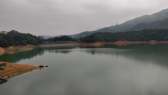
Located in the northeastern part of the New Territories, Solo Pon Village and neighbouring Lai Chi Wo are also located in the northeastern part of the New Territories, with nearly 170 villagers in its heyday in the 70s of the last century. This route is similar to the tour route of Lychee Wo Village mentioned above, find the downward path in the parking lot at the end of Wutengjiao, pass the Jiudan rental street sign, connect to the Sanli Ancient Road, and follow the road to Lychee Wo Village. After the tour and rest, walk into the path on the right side of Xiaoying School, cross the torii to the shore, and go around the bay to reach the ancient village. The village is located in the valley between Tiger Peak and Stone Bud, and there are many dense mangrove landscapes growing nearby. Walking around the village, I found that although the village has been abandoned for many years, the stone houses are still quite large, and the once lively courtyard is now covered with moss, and the decaying tiles between the vines exude a desolate beauty. After leaving the village, continue to walk along the mountain path, walk in the dense forest for a short time, arrive at Rongshuwa Village, where there are several traces of the British army stationed, and then arrive at Bogong Ao, which can overlook the Yantian Port of Shenzhen, and go down to the shore of Gupu and Fengkeng Village, and finally end the trip at the Lujiao Road bus stop. The route from Gupu to Lujiao has been mentioned in the introduction of "Lychee Nest", so it will not be expanded. Generally speaking, the road conditions of this Suoluo Bon tour route are not complicated, but the road is long and requires a certain amount of physical strength, and at the same time, some sections of the road that swim on the shore need to pay attention to the tide rise and fall time.
Recommended Attractions:
Lock the Luo Basin
(Difficulty: 3 1/2 stars)
Starting point: Parking lot at the end of Wutengjiao
Phoenix Mountain
At 934 metres above sea level, Phoenix Peak in central Lantau Island is the second highest peak in Hong Kong. There are two peaks in Phoenix Mountain, the main peak is the phoenix, the secondary peak is the phoenix, the mountain is often surrounded by clouds and mist, so the mountain is engraved with the four words "Phoenix Ethereal". Starting from the third section of Phoenix Trail near Pak Kung Pass bus stop, climb the stairs and gradually make the view of the airport and Tung Chung in the distance clear. After passing the rest pavilion, after going up for a while, you can see the Nantianmen on the left, which is shaped like a canyon, the Dogtooth Ridge with a precarious mountain behind it, and the Luohan Pagoda standing on the ridge. These three places are also famous places on Phoenix Mountain, but they are more difficult and suitable for energetic and experienced climbers. Return to the main trail and continue ascent, passing through multiple undulating hillsides before reaching the summit. Overlooking the four directions, the planes at the airport take off and land under the eyes, giving people the illusion of looking at all beings; On a sunny day, the silhouettes of Tuen Mun and Castle Peak in the distance are also clearly recognizable. Cross the hill and start the descent on the other side, some of the sections are close to the cliffs, but fortunately there are guardrails and steps, so it is still not too difficult. After arriving at Chopwood Pass, it turns into a long and straight stone slab step, which has a certain test of the leg strength of visitors. After more than half an hour's journey, you will arrive at the wooden archway of "Phoenix Viewing the Sun" and the Heart Sutra Jianlin, and then you can go to Ngong Ping along the road. To climb Phoenix Mountain, physical strength is the first consideration, and after reaching the top of the mountain after hardship, you may still be obscured by the clouds and fog entrenched nearby. Therefore, if you want to get to the top of Phoenix Mountain, you need to cooperate with the weather, which is also the charm of this route. December to February is a good time to climb Phoenix Mountain, because Hong Kong has little morning fog and thin clouds in winter, so you can have a better view when watching the sunrise.
Recommended Attractions:
Phoenix Mountain
(Difficulty: 3 1/2 stars)
Starting point: Pak Kung Au Bus Station
Lychee Village
Located on the southern shore of the Chek Mun Strait, Lai Chi Estate can easily be confused with Lai Chi Wo in the northeastern New Territories. As a local camping mecca, Lychee's ever-changing beach rocks make it a popular geological expedition site in Hong Kong. Get off at Pak Sha O Youth Hostel, find the cement road to Lai Chi Zhuang, go up the hill along the road, and follow the signs at the intersection to continue to choose the direction of Lai Chi Zhuang. There are not too many obstacles along the way, you can reach the village houses and camping sites of Lai Chi Zhuang, and walk along the coast, admiring the large mangrove forests and the surging tide. Then turn left on the shore and enter the Lizhuang Wharf, and then enter the Geopark, where you can see the volcanic sedimentary rocks on the shore, with a unique texture, like a washboard (similar to the previously mentioned dragon falling water and the "ghost washing board" in Miyazaki Aoshima, Japan, which belong to the same landform under erosion), and have a bit of abstract painting charm. Please note that it is illegal to excavate, destroy or deface any rock while in the Geopark. If you don't want to go further, you can take a ferry from Lychee Tram Pier to Ma Liu Shui to end the trip. To continue the journey, bypass Little Sandy Bay and walk through the jungle on the left (look for the ribbon markings) and catch the mud trail. The hiking trail on this stretch of Chicken Hemp Trail is relatively rugged and steep, full of gravel, and requires both hands and feet. After arriving at the launch station at the top of the mountain, embark on the mud trail and descend to Jishi Pass, where you can connect to the main path to Sham Chung. Go to the south cave for a while, and there is a stone carved with the word "snake stone" at the entrance of a trail on the left. Going down this road, you can see several slender white stone patterns on a large rock, which at first glance looks like a snake crawling on the stone, which is lifelike. Then return to the main trail and go all the way down, connect to the cement road and walk to the shore towards Yung Shue O Village, and finally end the trip at Sai Sha Road in Shui Lang Wo. If you don't want to take the bus, you can also take the ferry to Ma Liu Shui in Sham Chung.
Recommended Attractions:
Lychee Village
(Difficulty: 3 1/2 stars)
Starting point: Pak Sha O Youth Hostel
Crane Tsui
Hok Tsui Peninsula, located in the southeastern part of Hong Kong Island, is designated as a marine reserve in 1996 and is not allowed to engage in any water or coastal recreational activities to avoid damaging the marine ecology. Get off at Shek O Bus Stop and come to the swimming stall, find the store at the end on the right, and go up the stream to the right side of the store to the hiking trail, pay attention to the ribbon marks along the way. As the mountain rises, you will reach an open rock slope with a certain slope that you can climb directly or climb in the direction of the ribbon. After passing through the rocky slope, looking back at the top of Ta Na Cheng Peak and Longji in the distance, as well as the sparkling water of Shek O Beach, the clear blue water rushes to the sky. The rest of the trail up the hill gradually flattened until you reached the summit and saw the satellite communication station, and then followed the road down the road after the tour. Descend with the lane, there is a railing and cement trail on the left side of the right corner, go around the fence and go ahead, take the right trail at the next intersection, and then enter the shortcut down the hill on the right, and there is a ribbon at the entrance. The initial part of the route is steep and sometimes involves passing through rock crevices, and after a descending section, the landscape becomes open to the panoramic views of Po Toi Island, Wang Lan Island and Hok Tsui Marine Reserve, and then via the aqueduct to Hok Tsui Road and Hok Tsui Radio. Stepping on the cement road near the Hok Tsui radio station, find the right path and go down to the Institute of Marine Science and Leiyin Cave, the surging waves rush into the narrow hole, making a loud sound like thunder, and the momentum is compelling. Walk to the shore again, and after seeing the whale bone specimen, walk left along the coast to the crab hole. After the tour, return to Hok Tsui Radio Station and descend along Hok Tsui Road to the bus stop to end the tour. The difficulty of this route is that the trail to climb Hok Tsui Mountain in the first stage is quite difficult to walk, and there is a dense forest to block it, so it is recommended to wear gloves. If you find this route too difficult, you can also choose the route to the coastal reserve before Hok Tsui Road, which is a trail with a small gradient and can be navigated by children.
Recommended Attractions:
Crane Tsui
(Difficulty: 4 stars)
Starting point: Shek O Bus Station
Redstone doors
Hung Shek Mun is a narrow waterway between Gan Mun Tsui and Wan Chau in the northeastern New Territories, named after the red rock, which according to the AFCD of Hong Kong, is due to the violent oxidation of the iron contained in the rock. There are many side roads near the Redstone Gate, but there are many hidden paths, so you need to have a map and compass, and have a strong sense of direction. Find the path on the left side of the parking lot at the end of Wujiaoteng, walk to the direction of Sanhua Village according to the street signs, go right at the intersection of Jiudan Rental Road and Miao San Ancient Road, come to the front of the Lower Miao Tian Stone Monument, turn right into the trail to Datong and go up slowly, you can reach Datong on the Hengling. Soon after, at the intersection of Datong and Matoufeng paths, go left in the direction of Luhu Pass, and walk through the sparkling Plover Bay Tamsui Lake to reach Guanyin Pass. Follow the trail until you reach the intersection to the left of the warning sign towards the Red Rock Gate, where a ribbon is tied to a nearby tree as a guide sign. This path is quite hidden, but keeping in mind the descent and heading northeast will help you find your way. It takes about 30 minutes to reach the reservoir and a little further to Hongshimen Village, where the village houses are deserted, but you can still see traces of old life such as kitchens. Walking out of the abandoned house, walking along the cement road to the shore, the red rocks are impressive, the color of fire is more dazzling in the green mountains and green waters, meandering along the coastline, the scenery is charming; Due to the erosion of the sea breeze, the rocks are made into small holes, and the wind blows through the caves with a crisp whistle-like sound, which adds to the comfort of the journey. This place, known locally as "Salted Fish Cheng", is close to the coast, so visitors need to be aware of the time when the tide rises and falls, otherwise they will have to wade through. On the way back, you can choose to turn back the same way, or walk back to the Miaosan Ancient Road via Ngau Kok Chung and Wong Chuk Chung, but this route takes longer, and some sections of the road are more complex and lack road signs, so it is only suitable for experienced hikers who have a full grasp of the terrain and direction and have GPS equipment.
Recommended Attractions:
Redstone doors
(Difficulty: 4 stars)
Starting point: The parking lot at the end of Wujiaoteng
Jigong Ridge
Located in the northwest of the New Territories, Jigong Ridge, the ancient name of "Guijiao Mountain", is named because there are two peaks opposite each other on the top of the mountain, and the shape is like a horn. Take the car to get off at the basketball court in Fengji Township, keep left for a short while, go up the hill on the hidden path next to the telephone pole, there are wooden steps as a sign at the beginning, and friends who go for the first time need to pay more attention. Ascending the mountain, you can gradually see the scenery of nearby Kam Tin, Yuen Long, Nam Sang Wai and other places, and finally reach the sub-peak of Ji Kung Leg. After a short rest, continue towards the main peak, where the trail looms over the rolling hills, and the vegetation on both sides rushes to the peaks like waves. When you come to the top of Jigong Ling, you can see the whole Kam Tin and the whole picture of the New Territories Pat Heung, and to the north, you can see the high-rise buildings of Shenzhen, and from Shekou in the west to Sha Tau Kok in the east. Unlike the "Huashan Road" when going up the mountain, there are many branch roads on the downhill road in Jigongling and they are often shaded by plants, so it is recommended to bring your own map. After descending a section from the summit, turn right at the junction and continue to descend, then use an asphalt floor (a wartime reconnaissance bunker) as a reference, and find a trail to the Pink Kam Highway on the right to end the trip. The difference between the top and bottom of Jigongling is large, and there is no shelter in the whole process, so you must bring enough dry food and drinking water; At the same time, the downhill section is covered with weeds and slippery, so you need to be careful.
Recommended Attractions:
Jigong Ridge
(Difficulty: 4 stars)
Starting point: Jixiang basketball court
Lotus Mountain
Lianhua Hill and Phoenix Mountain are both famous peaks in the Lantau mountain range, and the main feature is the huge rock lying on the top of the mountain. Similar to Phoenix Mountain, Lotus Mountain has a large drop up and down, and less shade, whether it is a hot summer or rainy season mountaineering is dangerous, and the path is mostly hidden paths, visitors need to be fully prepared. Take the MTR to Tung Chung, then change to a bus and get off at Pak Mo Village, walk past the pavilion opposite, step on the cement road and head towards the valley, and find the climbing steps next to the incinerator. After climbing several hillsides, you can begin to see some famous peaks nearby, such as Poji Mountain, Phoenix Mountain, etc.; Similar to Dadong Mountain, Lotus Mountain is also planted with miscanthus grass, and in autumn you can enjoy the golden scenery all over the mountain. Walking on the mountain road, pay attention to the right side of the road, you can see a barrier composed of several small peaks, lying in the middle of the mountain, like a knife blade, sharp as if it is about to slide into the sky, it is the "thin blade". The route to this place is extremely dangerous, so don't try it without full preparation and dexterity. Continue up the hill along the road, walk through several sections of overgrown paths, and finally see the boulder lying flat on the top of the mountain, the "Bed of the Emperor", the smooth surface seems to be like a ghostly axe. Standing on the top of the hill, the scenery of Mui Wo is in full view, and Hong Kong Island and Kowloon are faintly visible in the distance. The route down the hill starts from the trail to the southwest of the Peak Marker, and then descends to the Phoenix Trail at Shuang Tung Pass and ends at South Lantau Road, where you can take the ferry back to Central at Mui Wo.
Recommended Attractions:
Lotus Mountain
(Difficulty: 4 stars)
Starting point: Baimancun bus station
The Wild Goose Valley Maze Trail
Yangu is because the travelers in the past saw that this valley is very similar to the posture of Yandang Mountain in Zhejiang Province, so it is named after "Little Yandang Valley", and a mountain trail opened up for prospecting at about 340 meters on the north slope of the Hanging Hand Rock is also called "Yangu Lost Path". This route is located in the western part of Mt. Ushishi, connecting the mountainside to the northern part of Hanghand Rock, passing through many famous and dangerous areas of Hanghand Rock, but the difficulty is slightly lower than other routes of Hanging Rock Rock. The whole route starts at Lee On Estate, walks east through the passage between Lee Hing House and Lee On House, crosses the back of the basketball court, steps on the path of the green belt on the left to the cement path on the left, walks straight to the bottom of the bridge, and then chooses another cement path on the right, and soon you will find the dirt road into the jungle on the left. The road is getting steeper and steeper, go left to the intersection and go down, at the intersection of Mawei Ridge, you see the warning sign "Do not go to Hanging Hand Rock", and you will start the Yangu Maze Trail when you step on the right path. Enter the maze trail, roughly along the northern part of the Hanging Hand Rock to the west, some sections are narrow, accompanied by a sharp descent, there are ropes on the way, but do not rely too much, and at the same time need to bring your own gloves; Visitors are advised to pay attention to the protruding parts of the rock wall, and after confirming safety, they will borrow the rock to climb up step by step. The slope of the latter section gradually gentles, and after passing through the woods, turn left at the second junction, and after a while, you will be able to exit the jungle and come to the open landscape of the Golden Ridge, which was once a gold mining site, hence the name. After bypassing the golden ridge, looking at the undulating mountains in front of you, the mountains on the left side are like an ape spreading its arms, embracing the wild goose valley, which is the "spirit monkey guarding the valley"; The canyon on the right is called "Golden Retriever Dog Gorge", named after the ferns commonly known as "Dog Hair Grass" that grow in the valley. Continue along the road, passing the entrance to the mountain stream of the Monkey Shougu Valley and the Golden Retriever Gorge, and walk out of the jungle to overlook Sha Tin and the city gate. Then arrive at the junction to Hanging Hand Rock, go down to the right to the pavilion, pick up the Ma On Shan Family Trail to the barbecue site, and go to Kam Ying Court via the Ma On Shan Bypass to end the trip. In addition to the main trail, there are many side roads to explore, but the terrain is complex and the path is steep and inconspicuous, so it is only suitable for experienced and prepared climbers. It is also an excellent place to see wild Hong Kong rhododendrons.
Recommended Attractions:
The Wild Goose Valley Maze Trail
(Difficulty: 4 1/2 stars)
Starting point: Lee On Estate